
Related items loading ...
Section 1: Overview
Name of Research Project
|
Related Project
|
Part
|
|
GWF-LSNPM: Linking Stream Network Process Models to Robust Data Management Systems (for the Purpose of Land-Use Decision Support)
|
|
|
|
|
|
|
|
Program Affiliations
Related Research Project(s)
|
GWF-LSNPM: Linking Stream Network Process Models to Robust Data Management Systems (for the Purpose of Land-Use Decision Support) | |
Dataset Title
Geomorphologic and Ecological Monitoring Data in Urban Watersheds at Ganateskiagon Creek (Durham), Wilket Creek (York), Morningside Creek (Scarborough) in Ontario
Additional Information
Creators and Contributors
|
Bruce MacVicar | PI | bmacvica@uwaterloo.ca | University of Waterloo |
Elli Papangelakis | Originator | epapange@uwaterloo.ca | University of Waterloo |
Patricia Huynh | Investigator | not available | University of Waterloo |
Stephen Murphy | Collaborator | stephen.murphy@uwaterloo.ca | University of Waterloo |
Abstract
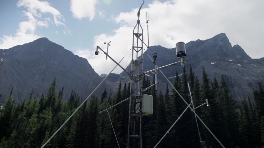
Hydrologic, geomorphological, invertebrate samples, and water quality data was collected from three rivers in the Greater Toronto Area: Ganatsekiagon Creek (Durham), Wilket Creek (York), and Morningside Creek (Scarborough). In all three sites, continuous water level data has been recorded between June 2015 and August 2018 at intervals ranging from 1–5 minutes during the active field season (April–December), and 7–10 minutes during the winter season. Repeated topographical surveys of 150–200 m length reaches have also been conducted at various resolutions. Approximately 3–6 repeat surveys have been completed in each site comprising of planform geometry and bathymetric data. Finally, bedload sediment has been monitored using Radio Frequency Identification tracer stones. A total of 300 tracers, in three sizes, have been seeded in each site. Tracer positions were recorded after each major rainfall event during the active field season each year, resulting in a total of 10, 12, and 13 recoveries in Ganatsekiagon Creek, Wilket Creek, and Morningside Creek, respectively. Invertebrates were collected using the Travelling Kick and Sweep Method outlined in the Ontario Benthos Biomonitoring Network Protocol at each site. Invertebrate samples were collected 16 times between 2015-2018, typically once a month from May–September. Water quality (dissolved oxygen, pH, water temperature) was measured during each invertebrate sampling event, and water samples were collected to measure for nitrates, soluble reactive phosphates, chlorides, conductivity, turbidity, total suspended solids, and sulfates. All water quality tests were conducted in the Ecology Lab (EV1-134) at the University of Waterloo.
Purpose
"Urban stream syndrome" describes the increased concentrations of nutrients and contaminants, modified channel morphology and stability, flashy hydrographs, and decreases in biodiversity in urban, lotic streams, because of increases in impermeable surfaces, intensive development, and poor storm water management. Although the hydrologic changes that result from urbanization have been extensively described, the effects of this hydrologic modification on other river processes is poorly understood. The purpose of this project is to understand the consequences of watershed urbanization on geomorphological and ecological processes of rivers through direct comparison of similar rivers with different watershed land-use scenarios. In particular, this project focuses on bedload sediment transport, water quality, and benthic macroinvertebrates. The aim is to use this research to help inform policies on restoration and conservation of urban rivers and aquatic ecosystems.
Funding for this data collection was provided by an NSERC Strategic Grant (STPGP 463321 – 14, Assessing and restoring
the resilience of urban stream networks). This data collected will also be used to support the project titled "Linking Stream Network Process Models to Robust Data Management Systems for the Purpose of Land-Use Decision Support", which is funded under the Global Water Futures Program funded by Canada First Research Excellence Fund.
Plain Language Summary
Keywords
|
Bathymetry |
Benthos |
Biodiversity |
Chloride |
Conductivity |
Conservation |
Contaminants |
Ecosystem |
Geomorphology |
Hydrology |
Invertebrates |
Morphology |
Nitrates |
Nutrients |
Ontario |
Oxygen |
pH |
Policy |
River |
Sediments |
Topographical surveys |
Turbidity |
Water level |
Water quality |
Watershed |
Water temperature |
Citations
MacVicar, B., Papangelakis, E., Huynh, P., & Murphy, S. (2019). Geomorphologic and Ecological Monitoring Data in Urban Watersheds at Ganateskiagon Creek (Durham), Wilket Creek (York), Morningside Creek (Scarborough) in Ontario. Waterloo, Canada: Canadian Cryospheric Information Network (CCIN). (Unpublished Data).
Section 3: Status and Provenance
Dataset Version
Dataset Creation Date
Status of data collection/production
Dataset Completion or Abandonment Date
Data Update Frequency
Creation Software
Primary Source of Data
Other Source of Data (if applicable)
Data Lineage (if applicable). Please include versions (e.g., input and forcing data, models, and coupling modules; instrument measurements; surveys; sample collections; etc.)
Section 4: Access and Downloads
Access to the Dataset
Terms of Use
Does the data have access restrictions?
Downloading and Characteristics of the Dataset
Download Links and Instructions
unavailable
Total Size of all Dataset Files (GB)
File formats and online databases
Other Data Formats (if applicable)
List of Parameters and Variables
 Metadata Editor
 Record List
 Alias List Editor
 Legacy sites

 GWFNet
 Master
 Research
 Map
Map
 Advanced
 Tools
Tools
 . . .
. . .