
Related items loading ...
Section 1: Overview
Name of Research Project
|
Related Project
|
Part
|
|
Core Modelling and Forecasting Team
|
GI
|
|
|
|
|
|
|
Program Affiliations
Related Research Project(s)
Dataset Title
Hydrologic simulations for North America generated with the Structure for Unifying Multiple Modelling Alternatives (SUMMA)
Additional Information
GeoNetwork Record:
Creators and Contributors
|
Wouter Knoben | Originator; Point of Contact | wouter.knoben@usask.ca | University of Saskatchewan |
Martyn Clark | Principal Investigator; Point of Contact | martyn.clark@usask.ca | University of Saskatchewan |
Vincent Vionnet | Collaborator | | Environment and Climate Change Canada |
Abstract
All data processing is tracked in scripts written in open-source languages and stored in a (currently private) Github repository to facilitate transparent and reproducible science. Input data includes:
-Time series of meteorological variables (precipitation, wind speed, temperature, shortwave radiation, longwave radiation, air pressure, specific humidity) from the ERA5 data set (Copernicus Climate Change Service, 2017)
-Digital maps of soil properties from the SOILGRIDS data set (Hengl et al., 2017)
-Digital maps of land use data from the MODIS MCD12Q1_V6 data set (Friedl et al., 2019)
-Catchment boundary and river network information from the Merit Hydro data set (Yamazaki et al., 2019)
References:
Copernicus Climate Change Service (C3S) (2017): ERA5: Fifth generation of ECMWF atmospheric reanalyses of the global climate, Copernicus Climate Change Service Climate Data Store (CDS), 2020-03-26.
https://cds.climate.copernicus.eu/cdsapp#!/home
Friedl, M., Sulla-Menashe, D. (2019). MCD12Q1 MODIS/Terra+Aqua Land Cover Type Yearly L3 Global 500m SIN Grid V006 [Data set]. NASA EOSDIS Land Processes DAAC. Accessed 2020-05-20 from
https://doi.org/10.5067/MODIS/MCD12Q1.006
Hengl T, Mendes de Jesus J, Heuvelink GBM, Ruiperez Gonzalez M, Kilibarda M, Blagotić A, et al. (2017) SoilGrids250m: Global gridded soil information based on machine learning. PLoS ONE 12(2): e0169748.
https://doi.org/10.1371/journal.pone.0169748
Yamazaki D., D. Ikeshima, J. Sosa, P.D. Bates, G.H. Allen, T.M. Pavelsky. MERIT Hydro: A high-resolution global hydrography map based on the latest topography datasets. Water Resources Research, vol.55, pp.5053-5073, 2019,
https://doi.org/10.1029/2019WR024873
Purpose
Model-agnostic benchmarking – development of a multi-scale, multi-variate model evaluation scheme that can be used to diagnose the process fidelity of any Earth System Model, as part of a wider model-agnostic benchmarking system. Objectives are:
1) Generate hydrologic simulations for the North America domain
2) Collect and synthesize multi-scale and multi-variate evaluation data
3) Define diagnostic evaluation metrics based on hydrologic theory and available data
4) Use the defined diagnostic evaluation metrics to assess process fidelity of the North America simulations
5) Define development goals for the model used to generate North America simulations
This project supports the geospatial intelligence theme of the GWF Core Modelling and Forecasting Team.
Plain Language Summary
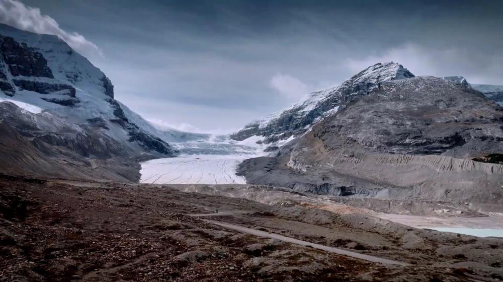
Hydrologic computer models are used to simulate the availability of water on the land surface. These simulations are important for many purposes, such as predicting how much water will be available for energy generation, agriculture, consumption, etc. These simulations are being performed for every stream and river basin in North America. The goal of this project is to improve the methods we use to see how accurate these simulations are.
Keywords
|
computational hydrology |
North America |
hydrological model simulation |
process-based hydrological model evaluation |
multi-scale hydrological model evaluation |
multi-variate hydrological model evaluation |
hydrological model performance benchmarking |
SUMMA |
Citations
Section 3: Status and Provenance
Dataset Version
Dataset Creation Date
Status of data collection/production
Dataset Completion or Abandonment Date
Data Update Frequency
Creation Software
Primary Source of Data
Other Source of Data (if applicable)
Data Lineage (if applicable). Please include versions (e.g., input and forcing data, models, and coupling modules; instrument measurements; surveys; sample collections; etc.)
Input data includes:
-Time series of meteorological variables (precipitation, wind speed, temperature, shortwave radiation, longwave radiation, air pressure, specific humidity) from the ERA5 data set (Copernicus Climate Change Service, 2017)
-Digital maps of soil properties from the SOILGRIDS data set (Hengl et al., 2017)
-Digital maps of land use data from the MODIS MCD12Q1_V6 data set (Friedl et al., 2019)
-Catchment boundary and river network information from the Merit Hydro data set (Yamazaki et al., 2019)
Model: SUMMA
Time step: hourly
Spatial resolution: variable
References:
Copernicus Climate Change Service (C3S) (2017): ERA5: Fifth generation of ECMWF atmospheric reanalyses of the global climate, Copernicus Climate Change Service Climate Data Store (CDS), 2020-03-26.
https://cds.climate.copernicus.eu/cdsapp#!/home
Friedl, M., Sulla-Menashe, D. (2019). MCD12Q1 MODIS/Terra+Aqua Land Cover Type Yearly L3 Global 500m SIN Grid V006 [Data set]. NASA EOSDIS Land Processes DAAC. Accessed 2020-05-20 from
https://doi.org/10.5067/MODIS/MCD12Q1.006
Hengl T, Mendes de Jesus J, Heuvelink GBM, Ruiperez Gonzalez M, Kilibarda M, Blagotić A, et al. (2017) SoilGrids250m: Global gridded soil information based on machine learning. PLoS ONE 12(2): e0169748.
https://doi.org/10.1371/journal.pone.0169748
Yamazaki D., D. Ikeshima, J. Sosa, P.D. Bates, G.H. Allen, T.M. Pavelsky. MERIT Hydro: A high-resolution global hydrography map based on the latest topography datasets. Water Resources Research, vol.55, pp.5053-5073, 2019,
https://doi.org/10.1029/2019WR024873
Purpose
Section 4: Access and Downloads
Access to the Dataset
Terms of Use
Does the data have access restrictions?
Downloading and Characteristics of the Dataset
Download Links and Instructions
Total Size of all Dataset Files (GB)
File formats and online databases
Other Data Formats (if applicable)
List of Parameters and Variables
 Metadata Editor
 Record List
 Alias List Editor
 Legacy sites

 GWFNet
 Master
 Research
 Map
Map
 Advanced
 Tools
Tools
 . . .
. . .