Water, Ecosystem, Cryosphere and Climate (WECC) Observatories
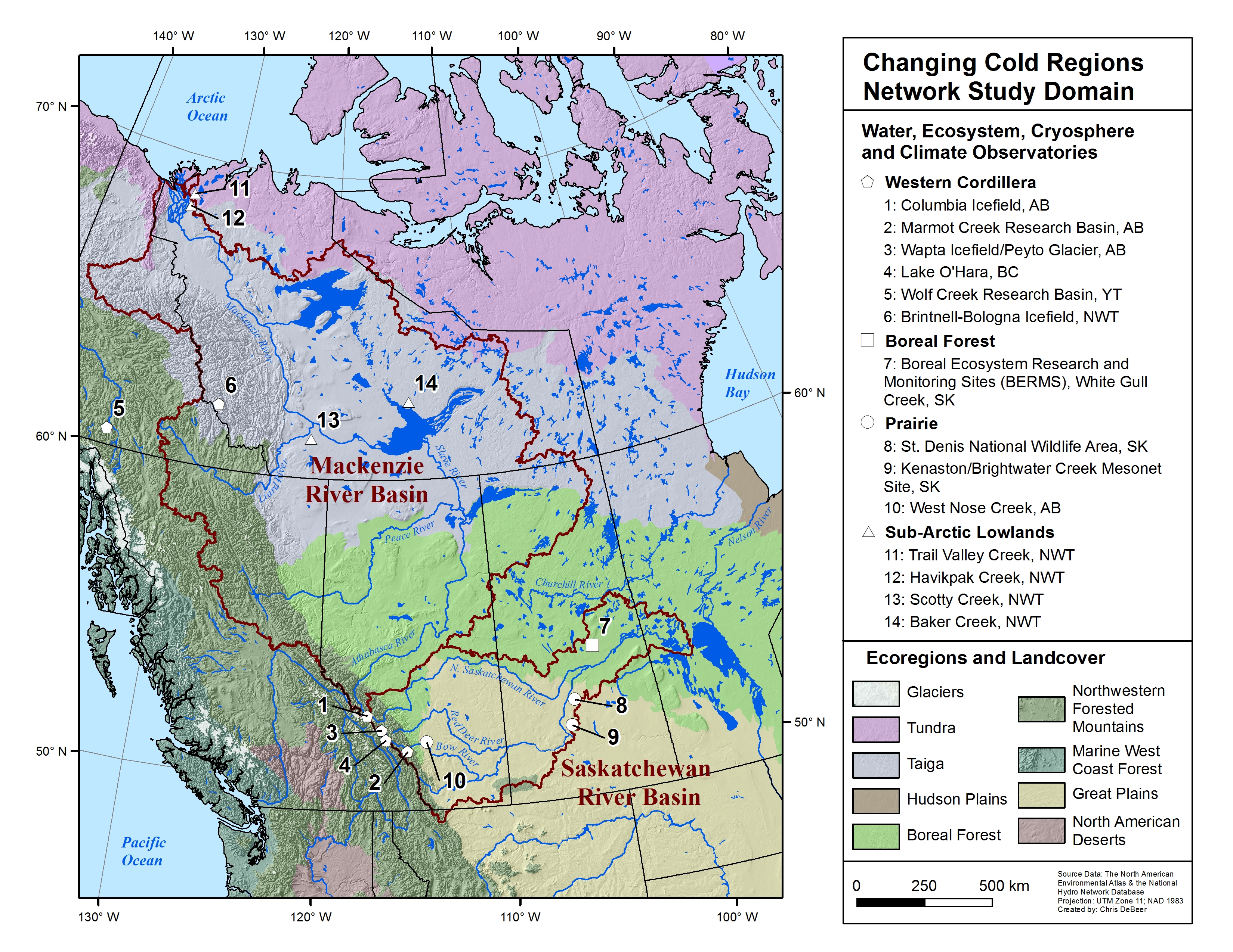
Map of the CCRN study domain and primary WECC observatories (click for larger image)
Through its members CCRN operates and uses a network of Water, Ecosystem, Cryosphere and Climate (WECC) observatories, distributed across the interior of western Canada. These all contain long-term observational records and legacy datasets, including hydro-meteorological variables, remote sensing observations, LiDAR topography, and soils, geology, and vegetation characterization. The WECC observatories exemplify the key cold region environments (Biomes) including the western Cordillera, Boreal Forest, Priaires, sub-Arctic Taiga Forest, and sub-Arctic Tundra.
Information on the data available and the content archived within the CCRN's database is available through http://giws.usask.ca/meta. Access to select datasets is available through http://giws.usask.ca/KistersWeb (Login name: public; Password: public), and further information on data can be found at http://www.ccrnetwork.ca/outputs/data.
We have organized a special issue of the journal Earth System Science Data where we have published data from many WECC sites, and where the interested reader can find more details about particular sites. Please see https://www.earth-syst-sci-data.net/special_issue901.html.
- Columbia Icefield, AB
- Marmot Creek Research Basin, AB
- Wapta Icefield / Peyto Glacier, AB
- Lake O'Hara, BC
- Wolf Creek Research Basin, YT
- Brintnell-Bologna Icefield, NWT
- Boreal Ecosystem Research and Monitoring Sites (BERMS), White Gull Creek, SK
- St. Denis National Wildlife Area, SK
- Kenaston / Brightwater Creek Mesonet Site, SK
- West Nose Creek, AB
- Trail Valley Creek, NWT
- Havikpak Creek, NWT
- Scotty Creek, NWT
- Baker Creek, NWT