The seaonal budgets presented below are averages over the 5-y study period. Also given on the boxes are the seasonal basin-average budgets. You can click on the figures to view bigger versions of the pictures.
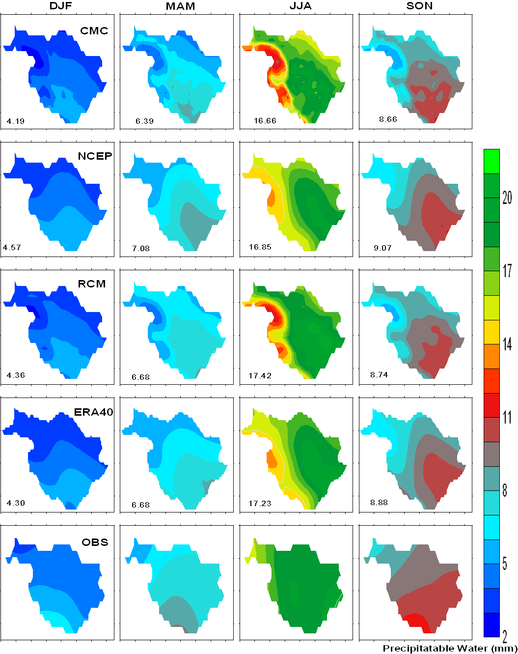
Figure 5.3.1 Atmospheric precipitable water (Q)
![]()
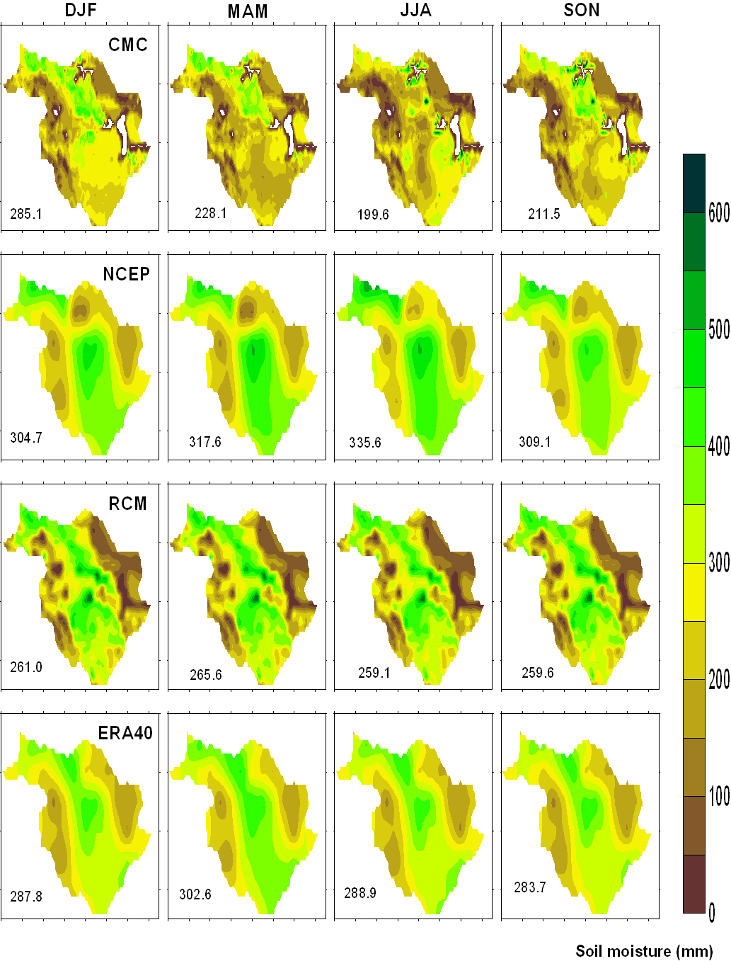
Figure 5.3.2 Soil Moisture (M)
![]()
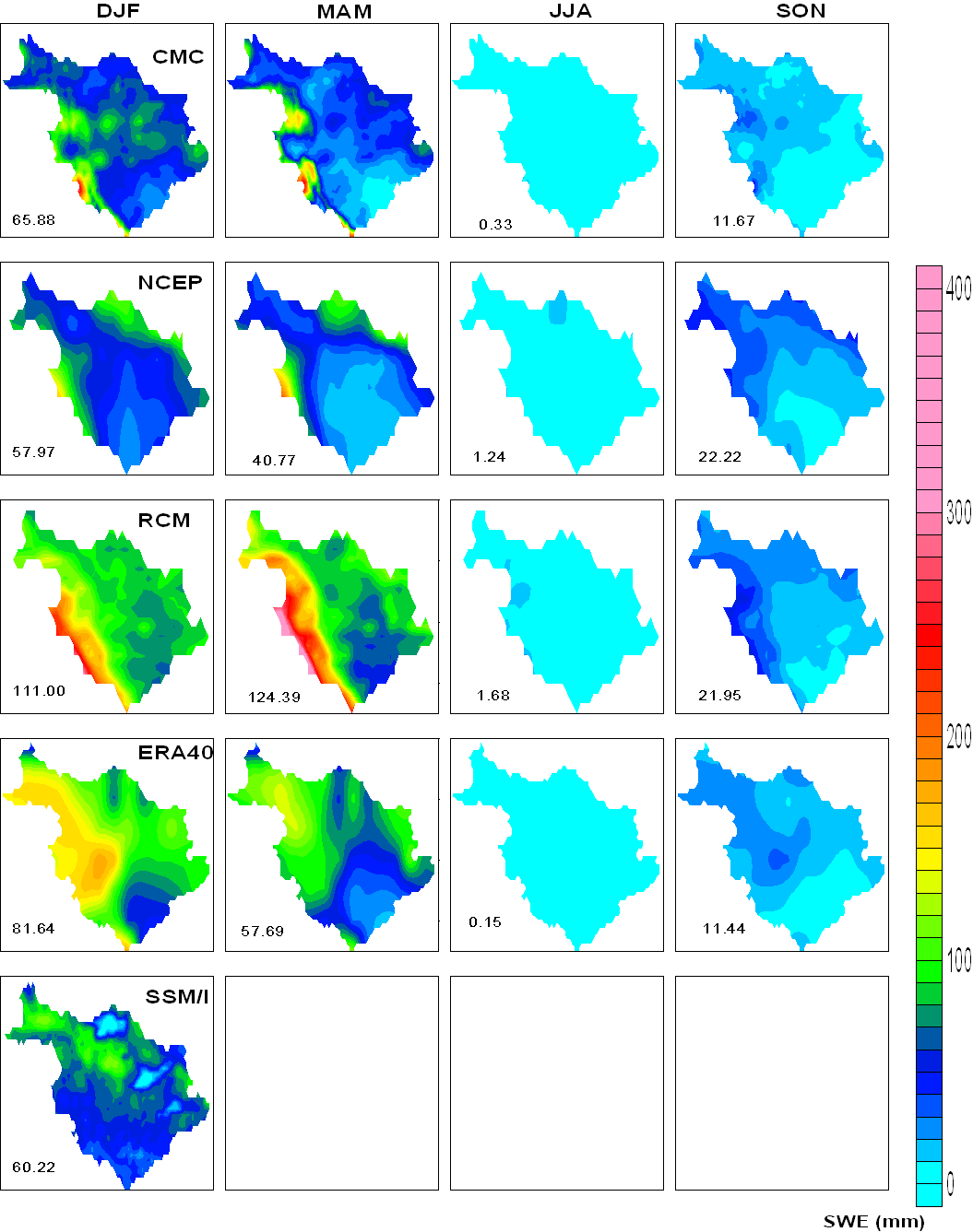
Figure 5.3.3 Snow (S)
![]()
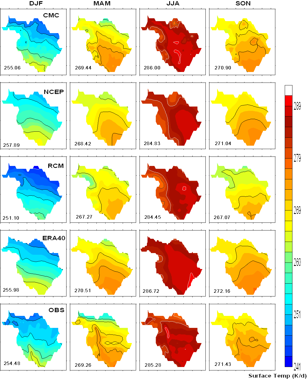
Figure 5.7 Surface Temperature (Ts)
![]()
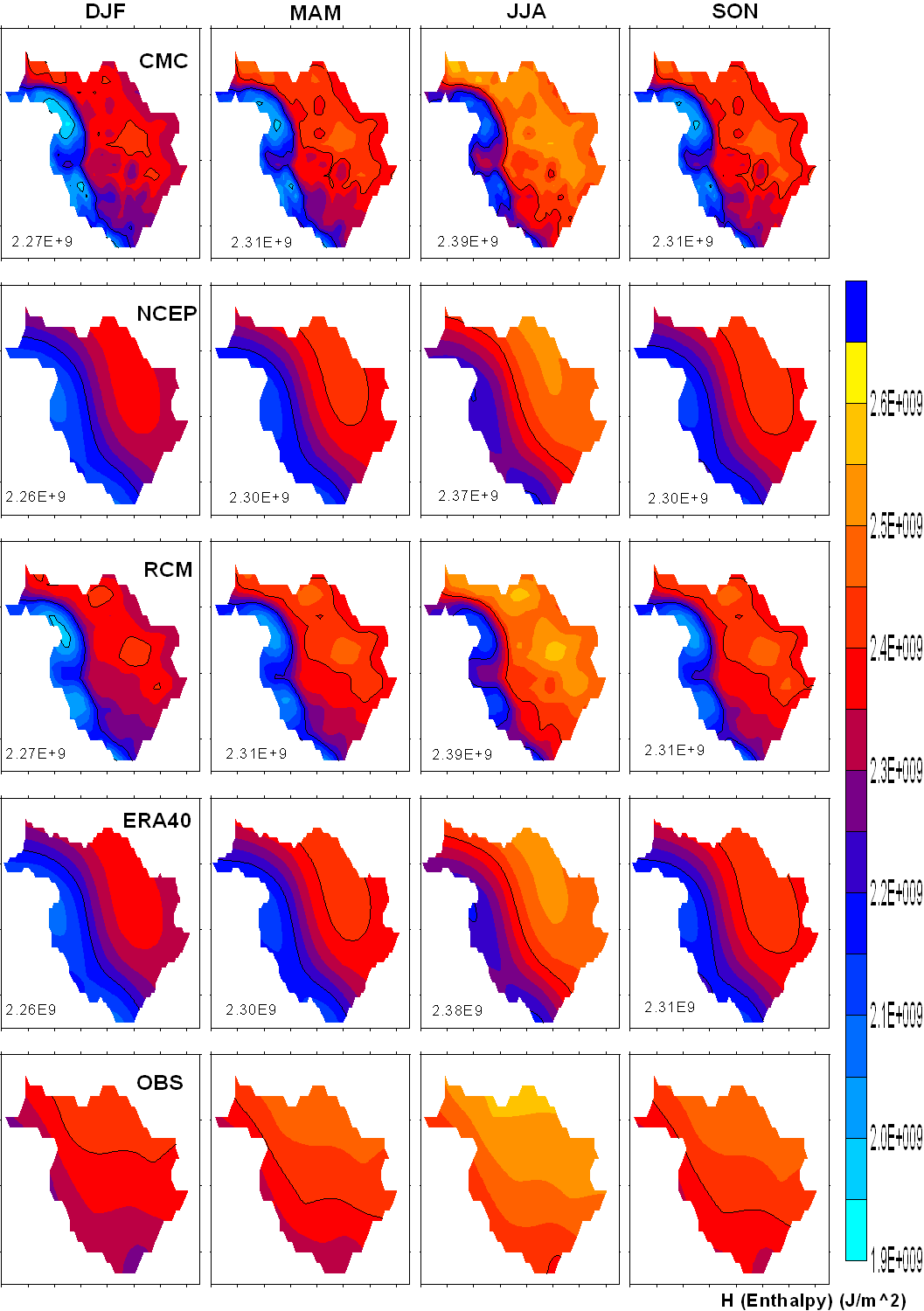
Figure 5.3.5 Enthlapy (H)
![]()
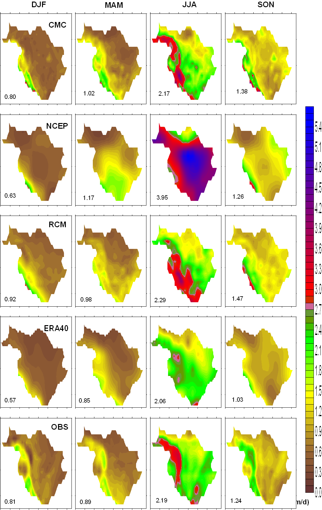
Figure 5.3.6 Precipitation (P)
![]()
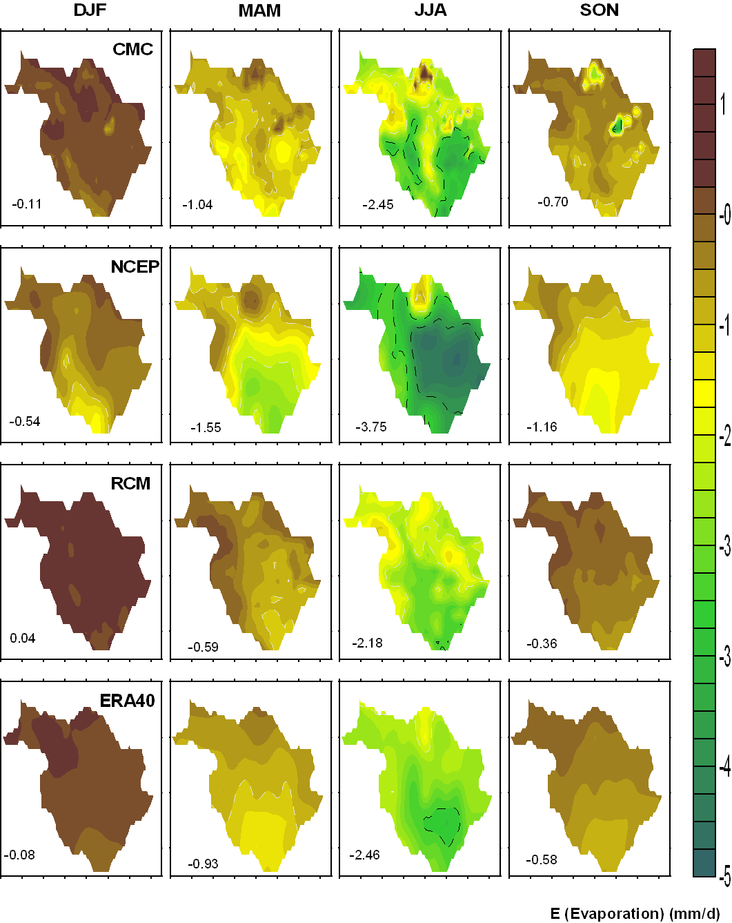
Figure 5.3.7 Evaporation (E)
![]()
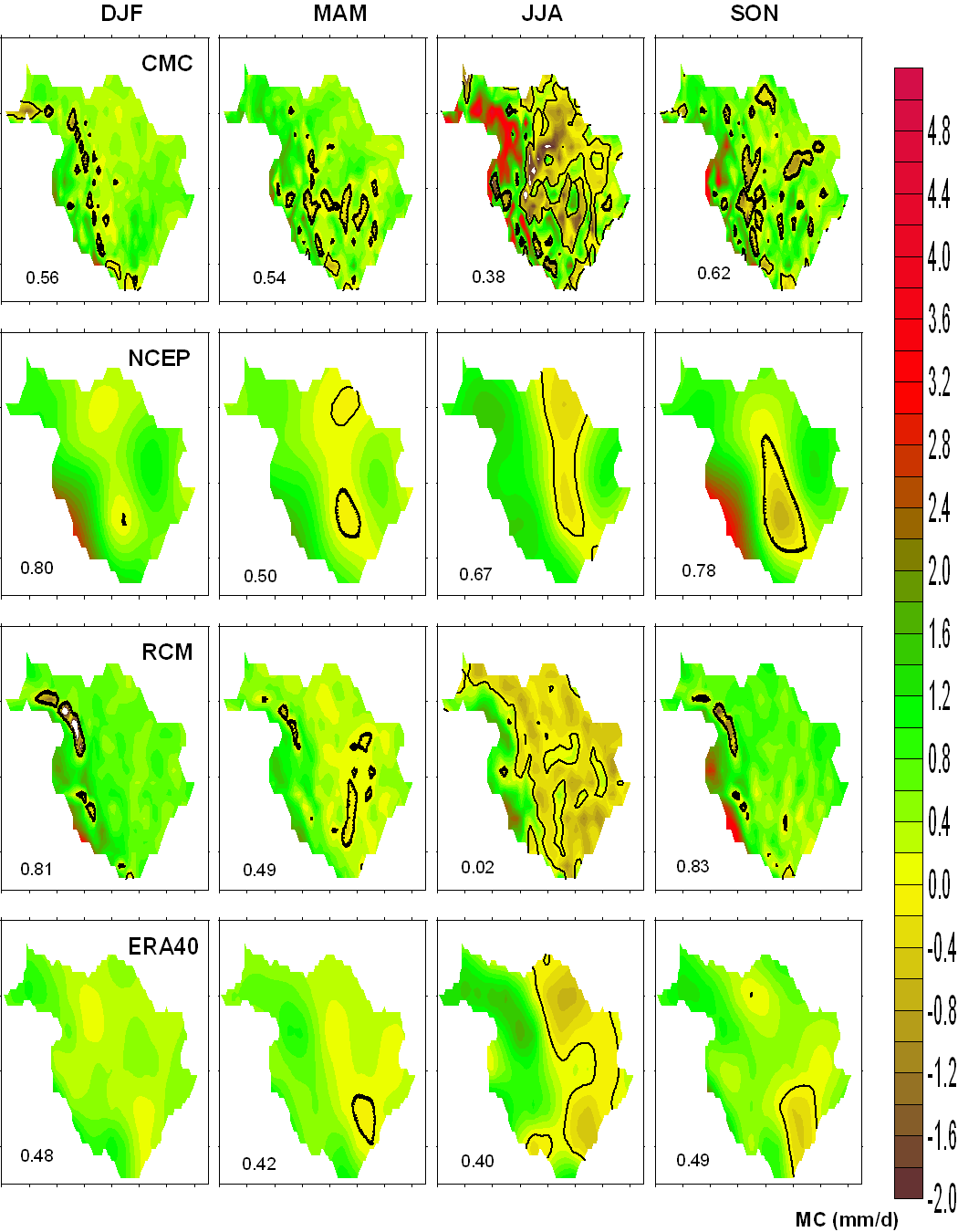
Figure 5.3.8 Moisture Convergence (MC)
![]()
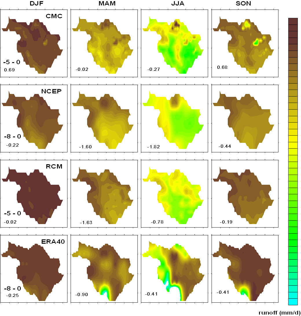
Figure 5.3.9 Runoff (N)
![]()
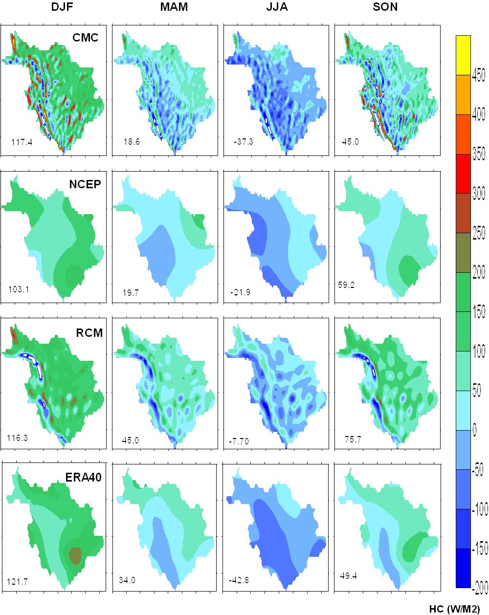
Figure 5.3.10 Dry Static Energy Convergence (HC)
![]()
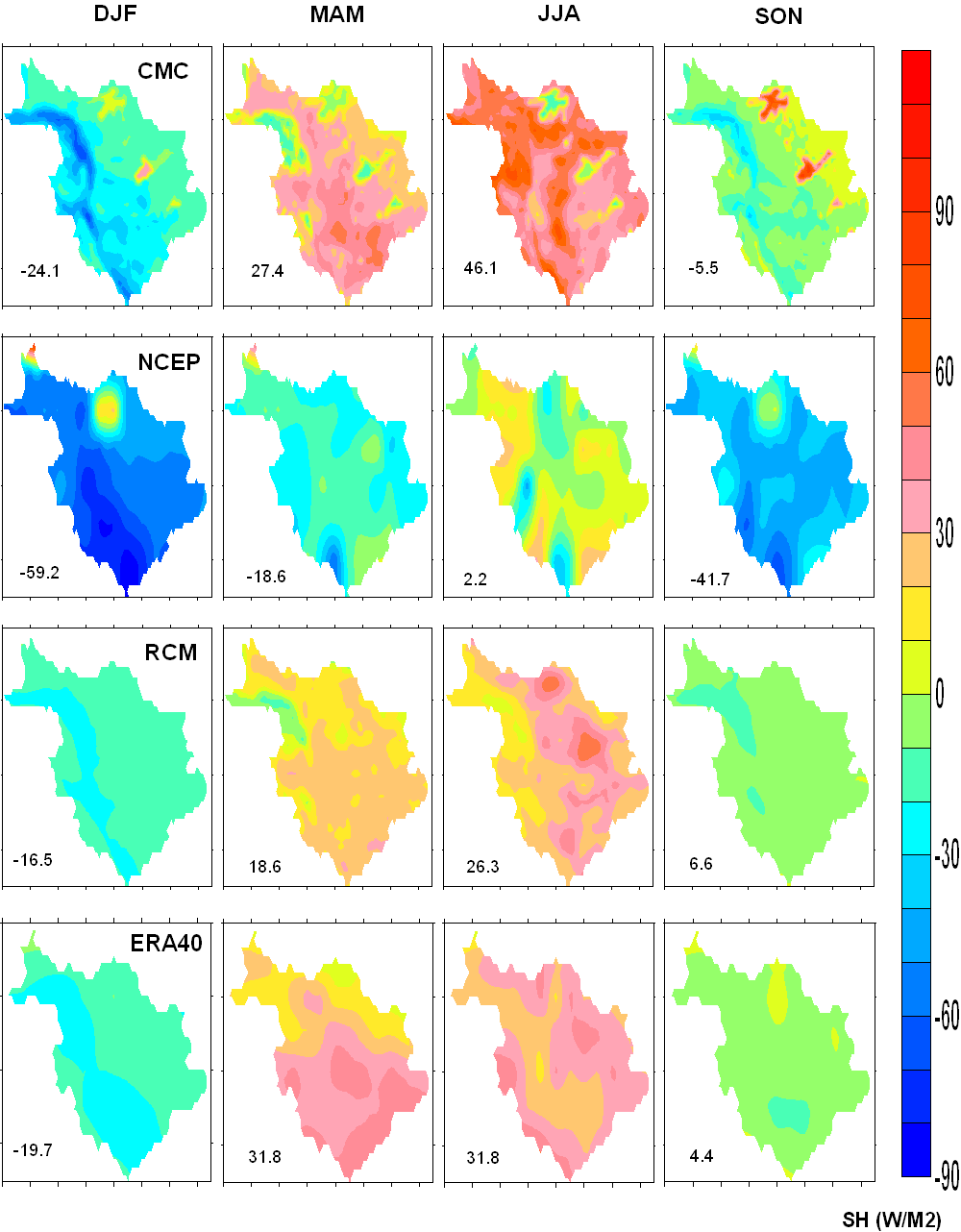
Figure 5.3.11 Sensible Heat (SH)
![]()
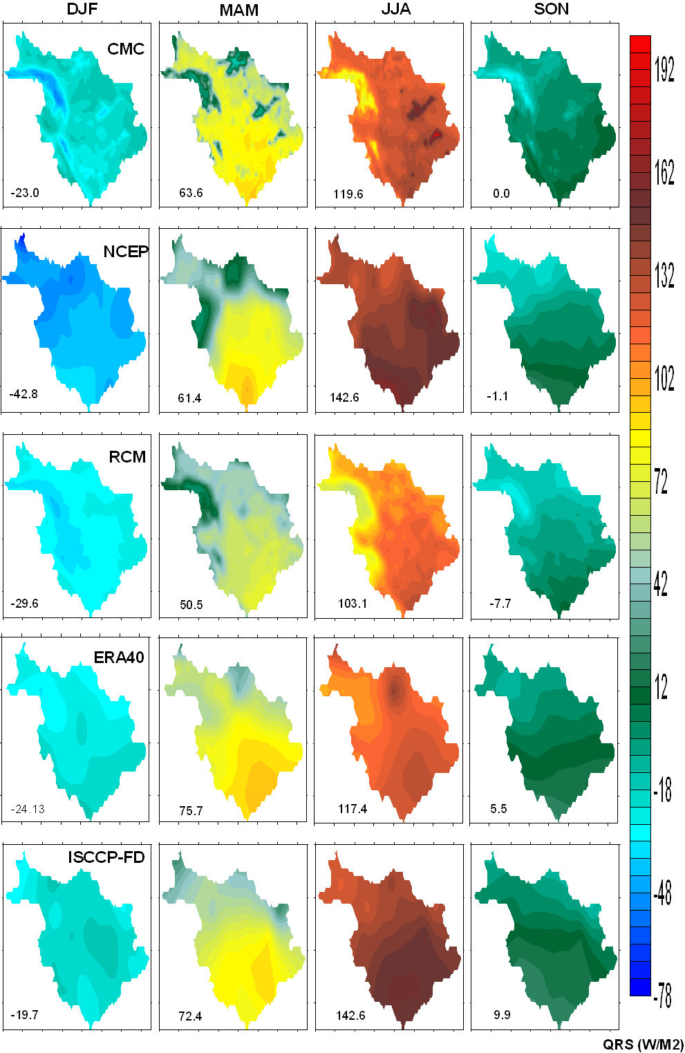
Figure 5.3.12 Surface Radiative Heating (QRS)
![]()
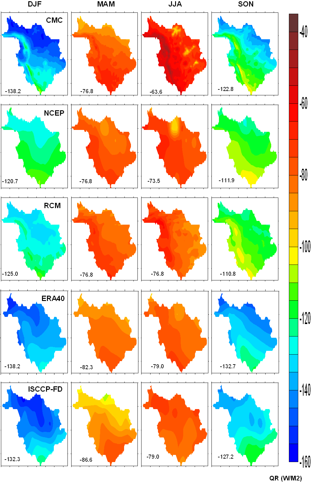
Figure 5.3.13 Atmospheric Radiative Heating (QR)
![]()
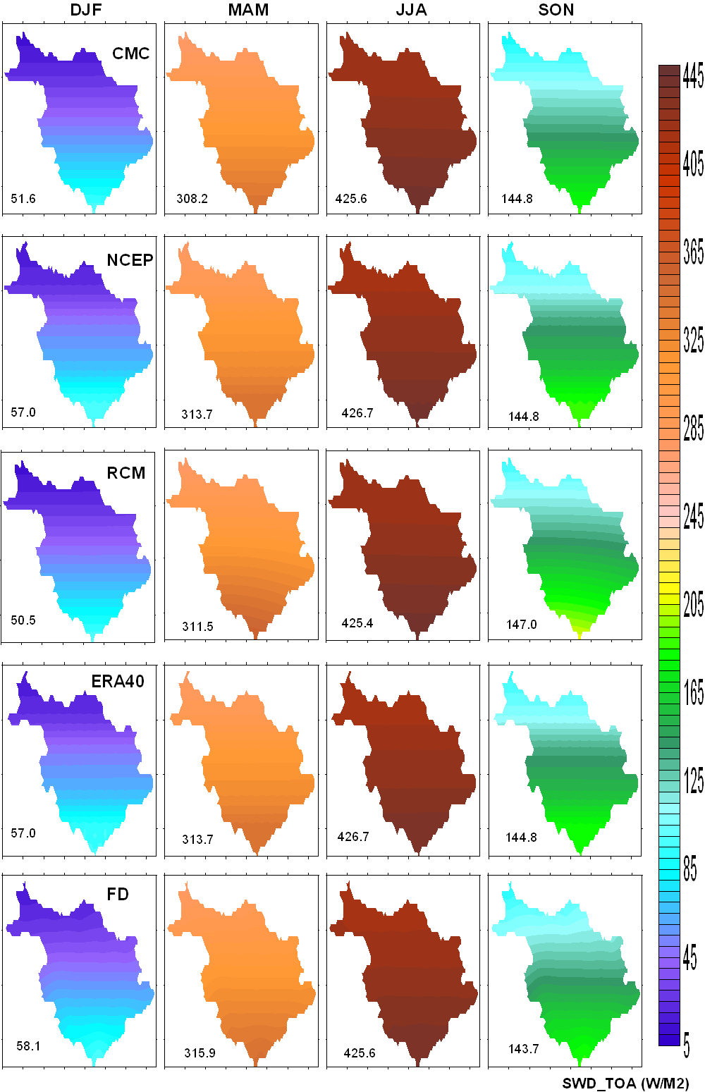
Figure 5.3.14 Top Of the Atmosphere Downward Short Wave Radiative Flux (TOA SWD)
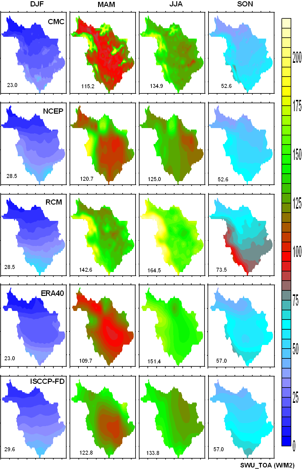
Figure 5.3.15 Top Of the Atmosphere Upward Short Wave Radiative Flux (TOA SWU)
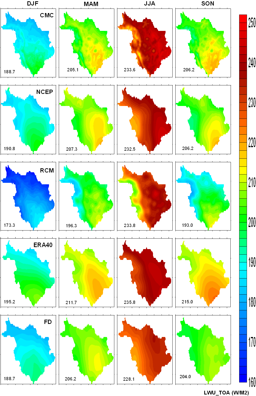
Figure 5.3.16 Top Of the Atmosphere Upward Long Wave radiative Flux (TOA LWU)
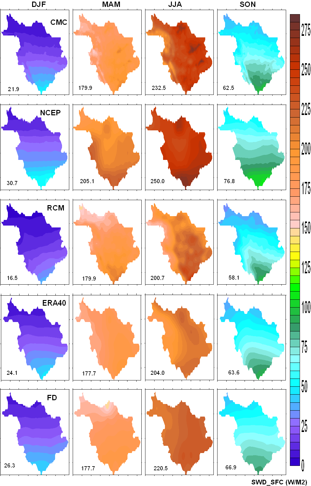
Figure 5.3.17 Bottom Of the Atmosphere Downward Short Wave Radiative Flux (BOA SWD)
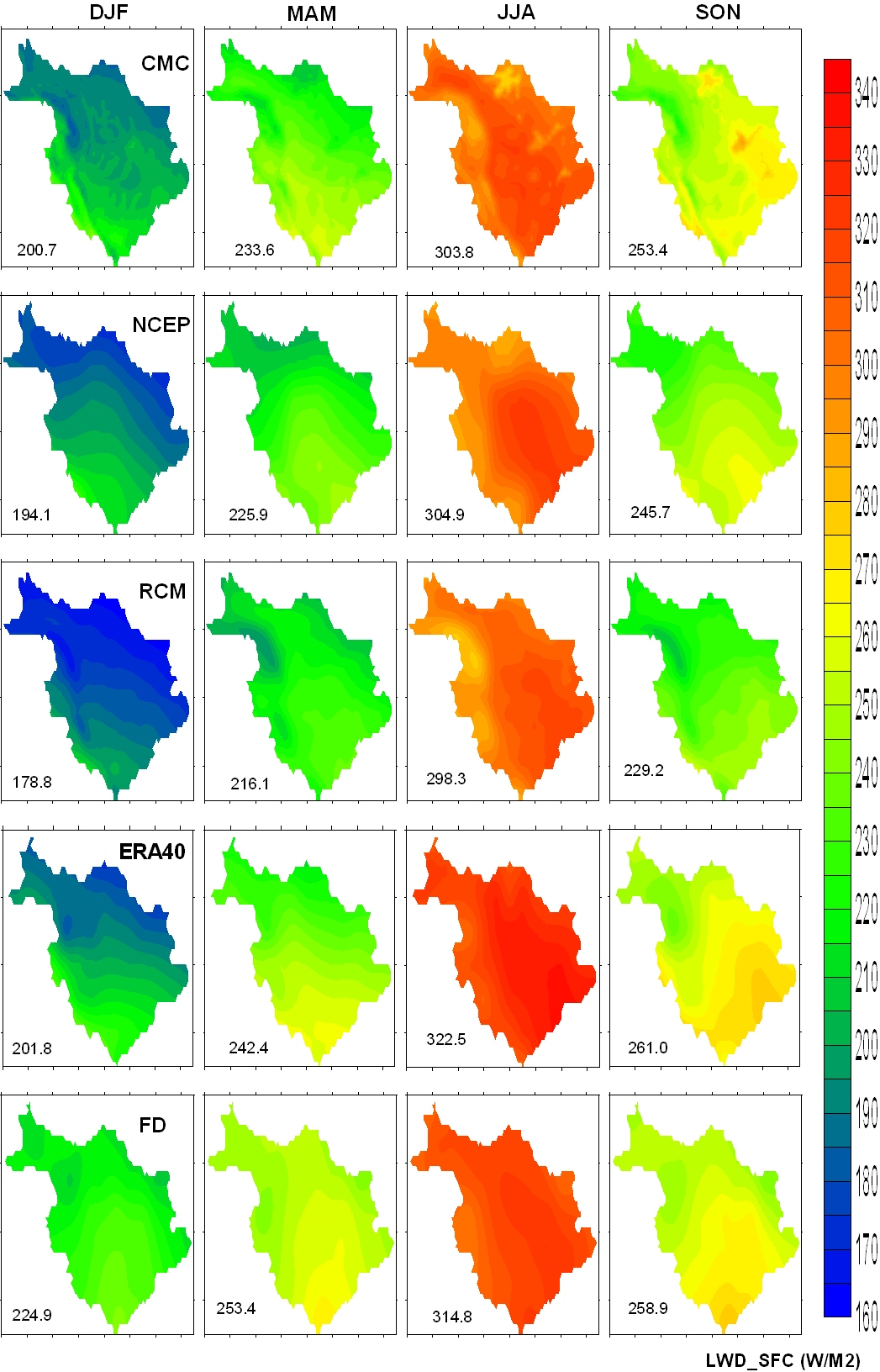
Figure 5.3.18 Bottom Of the Atmosphere Downward Long Wave Radiative Flux (BOA LWD)
![]()
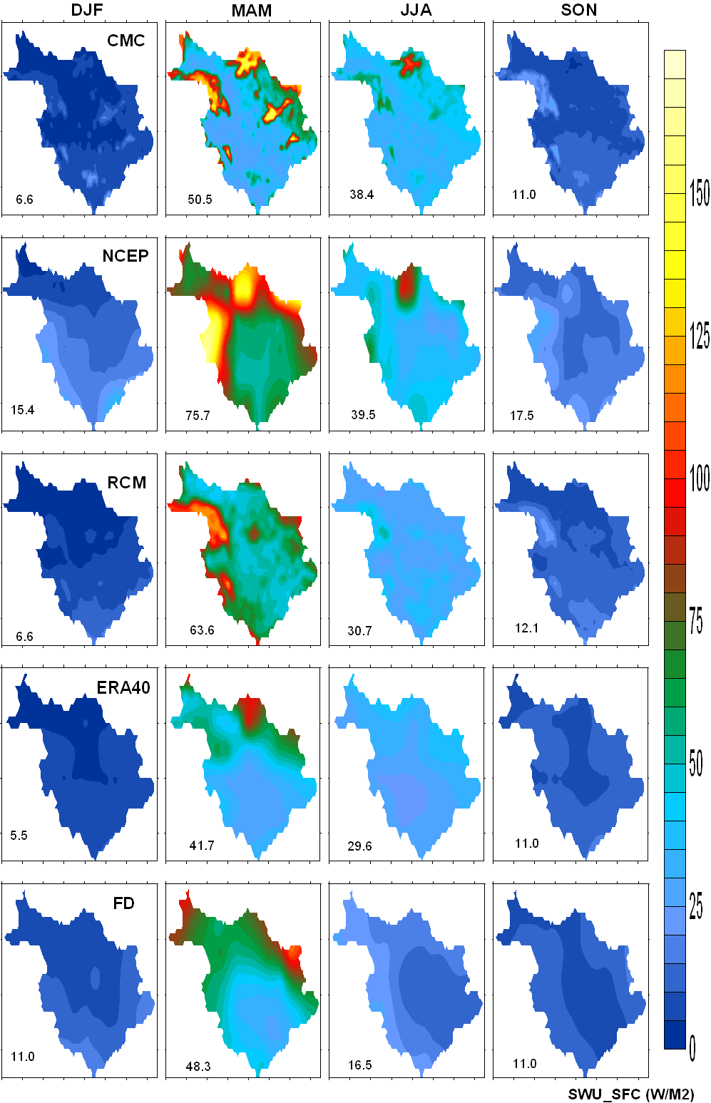
Figure 5.3.19 Bottom Of the Atmosphere Upward Short Wave Radiative Flux (BOA SWU)
![]()
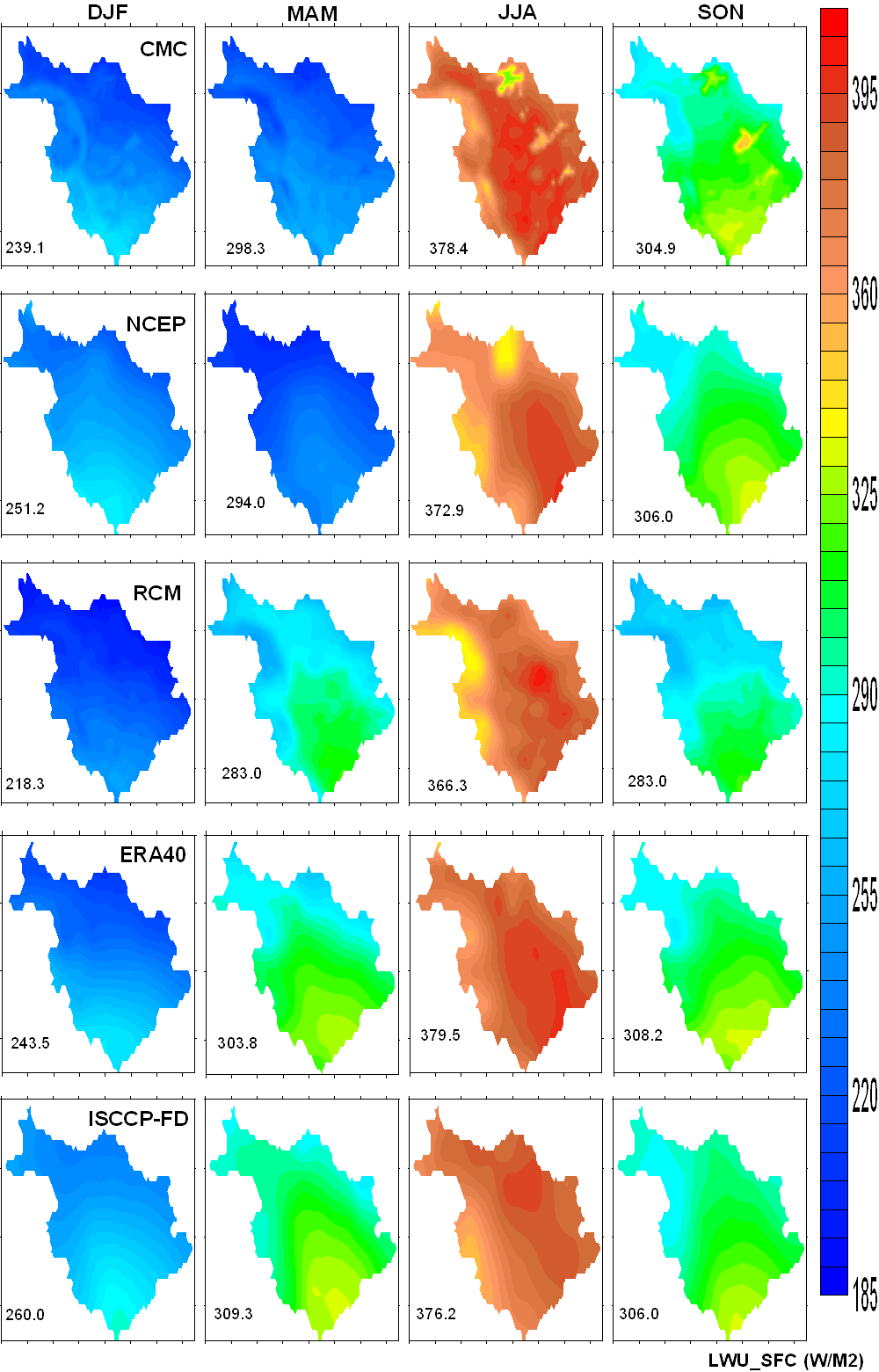
Figure 5.3.20 Bottom Of the Atmosphere Upward Long Wave Radiave Flux (BOA LWU)
![]()
Figure 5.3.21 Cloud Cover: The range of countour values for each datasets are different and are given on the plots rather than on the color scale.
![]()