


 Account Settings
 Metadata Editor
 Record List
 Alias List Editor
 Legacy sites

There are no Points of Interest selected in the Legend
So the Map is empty
So the Map is empty
Markers
Map Type
Legend
Miscellaneous
Basins
CRHO
Datasets
Agricultural Water Futures
Arctic Data Center
Boreal Water Futures
CCRN
Core Modelling and Forecasting
Aggregated gridded bedrock depth dataset for Mackenzie and Nelson-Churchill River Basin based on bedrock data by Shangguan et al. (2017)MapRecord
High-Resolution Meteorological Forcing Data for Hydrological Modelling and Climate Change Impact Analysis over most of North America, 1951-2100MapRecord
Diagnosing and Mitigating Hydrologic Model Uncertainty in High-Latitude Canadian Watersheds
Evaluation of ice models in large lakes
FORMBLOOM
Hydrological Processes in Frozen Soils
IMPC
An ensemble of 500 time series of weekly flows from 1600-2001 for the four sub-basins of the Saskatchewan River Basin generated through disaggregating tree-ring reconstructed flowMapRecord
Conditioned Shuttle Radar Topography Mission (SRTM) Digital Elevation Model (DEM) from HydroSHEDS at 90mMapRecord
Development of a hydro-economic model for the Great Lakes Basin using the input-output framework and disaggregated by sub-basinsMapRecord
Evaluation of Best Management Practice Scenarios for Reducing Total Phosphorous Loads into Lake Erie from the Grand River Watershed, OntarioMapRecord
Flood quantile estimates across Canada using the new probability distributions proposed for flood frequency analysis in CanadaMapRecord
Lake Futures
Abiotic and vegetation community data from Alnus alnobetula shrub and open tundra sites at Trail Valley Creek, NTMapRecord
Criteria-based ranking (CBR) A comprehensive process for selecting and prioritizing monitoring indicatorsMapRecord
Developing nutrient load-response relationships for total and dissolved reactive phosphorus for the three major tributaries to Lake St. ClairMapRecord
Flexible Subwatershed-based Lake and River Routing Products Available for Hydrologic and Land Surface Models for CanadaMapRecord
Fuzzy Cognitive Mapping Data for Perceptions of Lake Erie Eutrophication: Relationships among Critical ConceptsMapRecord
Input and Output Variables for the Biogeochemical Modelling Study of Lake Vansjo Response to Climate ChangeMapRecord
Relationship between soil CO2 fluxes and soil moisture Anaerobic sources explain fluxes at high water contentMapRecord
Linking Multiple Stressors to Adverse Ecological Responses Across Watersheds
Linking Stream Network Process Models to Robust Data Management Systems
Linking Water Governance
Managing Urban Eutrophication Risks under Climate Change
Mountain Water Futures
Daily temperature data from the Foothills Climate Array Mesonet, Canadian Rocky Mountains, 2005-2010MapRecord
Evapotranspiration and energy partitioning across a forest-shrub vegetation gradient in a subarctic, alpine catchmentMapRecord
Hydrological and meteorological dataset from the Lake O'Hara alpine hydrological observatory, 2004-2017MapRecord
Hydrometeorological data collected at Wolf Creek Research Basin, Yukon Territory, Canada over 1993-2014MapRecord
Hydrometeorological, glaciological and geospatial research data from the Peyto Glacier Research Basin in the Canadian RockiesMapRecord
Measurements And Controls On Mid-Winter Alpine Ground Thermal Regime In The Purcell MountainsMapRecord
Next Generation Solutions for Healthy Water Resources
Alterations of gut microbiota in walleyes from the North Saskatchewan River following an oil spillMapRecord
Characterization of high mountain glacier microbiota following inundation with wildfire sootMapRecord
Differential sex responses of fathead minnow (Pimephales promelas) gut microbiota to a short-term environmentally-relevant aqueous exposure to benzo[a]pyreneMapRecord
DNA and RNA zooplankton metabarcoding to assess the efficacy of different oil spill clean-up techniques in a boreal lakeMapRecord
Response of finescale dace (Phoxinus neogaeus) gut microbiome to in situ experimental selenium exposureMapRecord
Responses of juvenile fathead minnow (Pimephales promelas) gut microbiota to a chronic dietary exposure of benzo[a]pyreneMapRecord
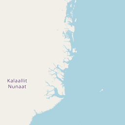
Northern Water Futures
Contaminant Biomonitoring in the Northwest Territories Mackenzie Valley Investigating the Links Between Contaminant Exposure, Nutritional Status, and Country Food UseMapRecord
Controls on freezing-thaw cycles in a fully coupled thermo-hydro-mechanical system in permafrost areaMapRecord
Data for Subsurface flow measurements using passive flux meters in variably‐saturated cold regions landscapesMapRecord
Drivers of variation in fish mercury and fatty acids levels in lakes of the Dehcho region of the Northwest TerritoriesMapRecord
Environmental and plant community composition and functional trait data across peatlands of the Forest Dynamics Plot at Scotty Creek, NTMapRecord
Geochemical, biotic, and ecological data for an investigation of drivers of variation in fish mercury concentrations between Kakisa and Tathlina Lakes, Northwest TerritoriesMapRecord
Gross primary production and environmental observations for a mature black spruce site located in central Saskatchewan, Canada, for the period Sep-2018 to Dec-2020MapRecord
Identifying functional impacts of heat-resistant fungi on boreal forest recovery after wildfireMapRecord
Investigating plant community composition and functional traits across the latitudinal extent of the western boreal forest of CanadaMapRecord
Investigating the spatial and temporal variability in greenhouse gas dynamics in Arctic tundraMapRecord
Investigation of alpine land cover classes and their influence on basin water balance in the Mackenzie Mountains, Northwest TerritoriesMapRecord
Near-surface permafrost ground ice characteristics and ecological and physical drivers of transient layer ice content in discontinuous permafrost, Yellowknife, Northwest TerritoriesMapRecord
Peatland porewater chemistry for select mining pollution-affected peatlands in the area surrounding Yellowknife, NTMapRecord
PhenoCam Dataset v2.0 Vegetation Phenology from Digital Camera Imagery, 2000-2018 (U. Montreal)MapRecord
Relationship between dissolved organic matter and disinfection by-product formation from waters near Yellowknife and Wekweeti, Northwest TerritoriesMapRecord
Spatiotemporal patterns of mining-associated metals in lake sediments near Yellowknife, Northwest TerritoriesMapRecord
Prairie Water
Sensors and Sensing Systems for Water Quality Monitoring
Significance of Groundwater Dynamics within Hydrologic Models
Sub-Arctic Metal Mobility Study
Application of artificial substrate samplers to assess enrichment of metals of concern by river floodwaters to lakes across the Peace-Athabasca DeltaMapRecord
Transformative Sensor Technologies and Smart Watersheds
Water knowledge camps Datasets
Winter Soil Processes in Transition
Characterizing temporal and spatial changes to the soil microbiome through the winter transition and freeze-thaw cycles in agricultural fertilizer amended soilsMapRecord
Impact of non-growing season freeze-thaw conditions on nutrient cycling and Fall-applied fertilizersMapRecord
GWF
Research Sites
GWFO
INARCH/COPE
Catchments
Datasets
Glaciological, hydrological, meteorological observations and isotopes sampling results during 2007-2017 at Djankuat Glacier Station in the North Caucasus, RussiaMapRecord
Hydrometeorological data collected at Wolf Creek Research Basin, Yukon Territory, Canada over 1993-2014MapRecord
Stations